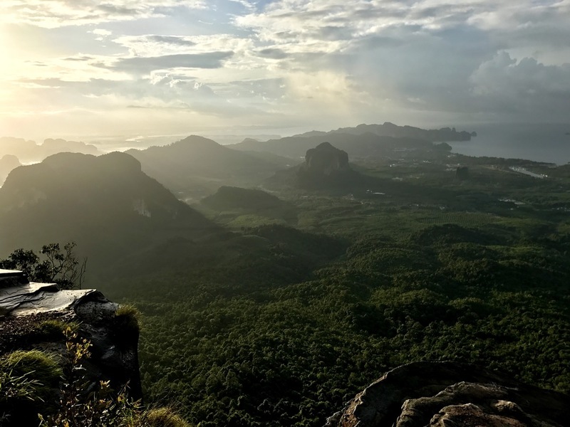
Kao Hang Nug
Krabi province is famous for its cliffs. The #NagaTail ridge is one of the best places where you can enjoy its beauty at the fullest.
You will meet 3 different names for this place:
#KaoHangNug (เขาหางนาค) - the Tail of Naga;
#KaoNgonNug (เขาหงอนนาค) – the Ridge of Naga;
#TubKaek (ทับแขก) - it is also the name of the neighboring beach.
Mount Kao Hang Nug (Naga Tail) is a ridge that starts from the Tub Kaek beach on the West coast of #Krabi and stretches to the East. You can climb up and down the mountain in one day, but if you want to really enjoy the beauty of this place, you need to camp there for the night. In contrast to the temple Wat Tham Suea, road to the top runs through the jungle. The length of the hike to the top is 3.7 km, with a visit to a waterfall along the way is 4.7 km.
! Directions: to get to the starting point of the hike head to the Tub Kaek beach (ทับแขก), then follow the signs to the Hat Noppharat Thara - Mu Kho Phi Phi National Park.