Travel guide Thailand
Langkawi, Malaysia
We have included this island because it can be easily reached from Koh Lipe by a high-speed ferry. The ferry operates from Bundhaya Resort on Pattaya Beach twice a day from mid-October to the end of May. The trip takes one hour.
Boat schedule:
Lipe – Langkawi 10:30, 16:30*
Langkawi – Lipe 9:30, 14:30*
A one-way ticket cost 1200 baht for an
adult and 720 baht for a child
*Afternoon departures are only available from October to May.
!Please, make sure that you don’t require a visa to enter Malaysia before the trip. If you overstayed your Thai visa an overstay fine should be paid at an Immigration office in the city of Satun on the mainland prior to departure to Malaysia by ferry.
Once you reach Langkawi take a taxi to Pantai Cenang. That is where most of the hotels are located.
If you want to explore the Island rent a motorbike. It costs anywhere from 300 – 800 Malay Ringgit (approx. 300 – 800 baht) depending on season and size of the engine.
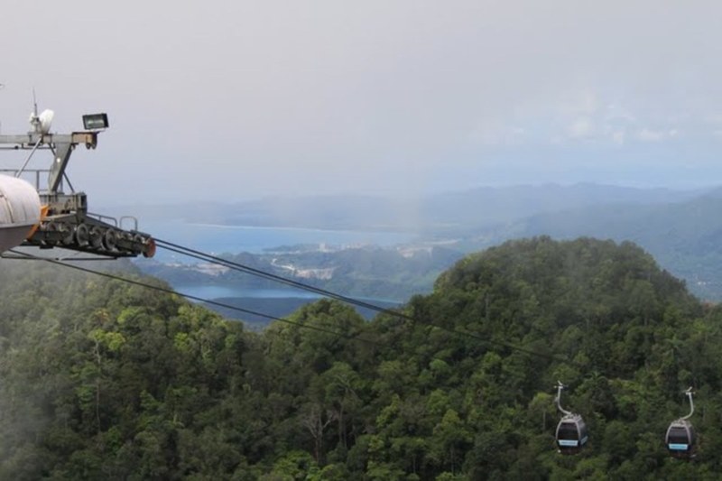
Cable Car
Coming from Koh Lipe to Langkawi by ferry you will certainly notice a sparkling building on the side of a mountain. Once you get closer you will be able to see gondolas moving on the cable. Malays are well-versed in construction of beautiful monumental projects.
The cable car ride split into 2 sections with a total distance traveled of 2.2 km. When you get to the top station you can go up to an observation deck that is located at 708 m above sea-level. There is also an unusual suspension/sky bridge connecting two mountain peaks.
Clouds at the top bring a pleasant relief from the heat and are so close that you feel like you can touch them.
From Phuket South of Thailand
For many people, the word “South” evokes warm feelings and beautiful images. South of Thailand does not disappoint expectations. People living in the South of Thailand are open and easy going.
Everyone knows that migratory birds fly to the South, but not many know that they stop in Thailand. Follow the path of migratory birds, go to the South and you might get a chance to meet them at Thale Noi Waterbird Reserve, place unknown to most. But we will talk about this in due time…
Following provinces and places of interest should be included
Here are rental rates for water taxis to nearby islands
WORKING HOURS
08:00 — 16:00
Islands: Poda + Tub
Max. occupancy: 4
Duration: half of the day
Price for boat in Thai baht: 1 700
Islands: Poda + Chicken
Max. occupancy: 4
Duration: half of the day
Price for boat in Thai baht: 1 700
Islands: Poda + Tub + Chicken + Phranang cave
Max. occupancy: 6
Duration: 8:00 - 16:00
Price for boat in Thai baht: 2 200
Island: Hong
Max. occupancy: 6
Duration: 8:00 - 16:00
Price for boat in Thai baht: 2 500
A one-way join-in water taxi ticket to the #Railay West beach and Phranang costs 100 baht per person. But you will need to wait until the boat has at least 8 passengers. A private transfer costs 800-1000 baht.
Have a great trip!
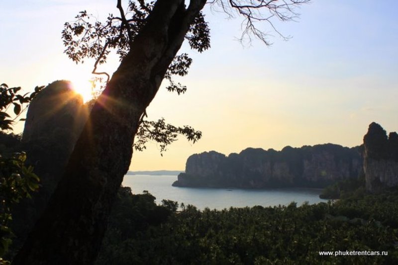
Ao Railay
Railay peninsula can only be reached by boat. On Railay West beach you can swim at high tide. There is a path that connects Railay West to Railay East. Railay East is not good for swimming, but it is a favorite spot for rock climbers. There are many climbing routes of different difficulty. You can rent equipment and hire an instructor.
Moving further along the coast to the South along the cliff you can walk to the southern part of the peninsula called Phranang, home to a cave that carries the same name. According to legend, the spirit of a woman called Phranang lives in the cave. One day her husband went fishing to sea, but a strong storm developed and he never returned. The woman remained faithful and waited for him all her life.
It is believed that if you want stability in family matters or if you want to have children or meet a man you need to make a special gift to the spirit of Pranang. This gift should be a phallus cut by you from a piece of wood. Locals also believe that even if you release such a gift into the sea anywhere in #Krabi, it will float toward the cave. Men also bring offerings in the form of flowers and food when they go fishing to ensure a safe return home and a good catch.
Walking on the path from East Railay to Phranang Beach you will see a trail to the viewpoint and to the inner lagoon. If you decide to go there please, note you will need to climb rocks, sometimes using a rope, therefore, wear appropriate shoes or go barefoot (the rocks are smooth).
! We do not recommend you to climb to the view point after the rain.
A one-way water taxi ride to the #AoRailay West beach and Phranang costs 100 baht per person. But you will need to wait until the boat has at least 8 passengers. A private transfer costs 800-1000 baht.
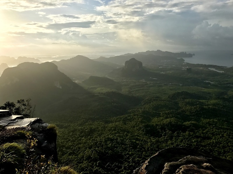
Kao Hang Nug
Krabi province is famous for its cliffs. The #NagaTail ridge is one of the best places where you can enjoy its beauty at the fullest.
You will meet 3 different names for this place:
#KaoHangNug (เขาหางนาค) - the Tail of Naga;
#KaoNgonNug (เขาหงอนนาค) – the Ridge of Naga;
#TubKaek (ทับแขก) - it is also the name of the neighboring beach.
Mount Kao Hang Nug (Naga Tail) is a ridge that starts from the Tub Kaek beach on the West coast of #Krabi and stretches to the East. You can climb up and down the mountain in one day, but if you want to really enjoy the beauty of this place, you need to camp there for the night. In contrast to the temple Wat Tham Suea, road to the top runs through the jungle. The length of the hike to the top is 3.7 km, with a visit to a waterfall along the way is 4.7 km.
! Directions: to get to the starting point of the hike head to the Tub Kaek beach (ทับแขก), then follow the signs to the Hat Noppharat Thara - Mu Kho Phi Phi National Park.
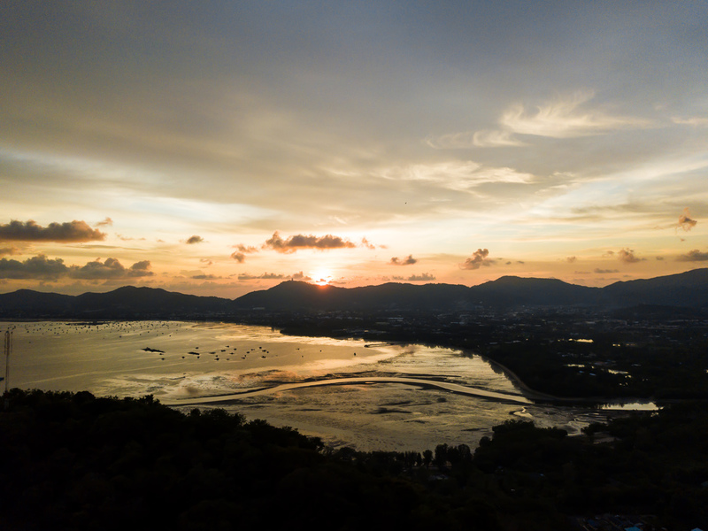
Viewpoint at Cape Panwa
WORKING HOURS
18:00
COORDINATES
GPS
7°49'30.6"N 98°22'53.2"E
Decimal
7.825157, 98.381432
Official name is Kao Khad Views Tower. The site offers a 360° view. It is the best place to see sunrise, the southern part of Phuket Town and the Bay of Chalong. View point on west coat will not offer you same sunrise view. From here you even can see Big Buddha, although it not so big from such distance.
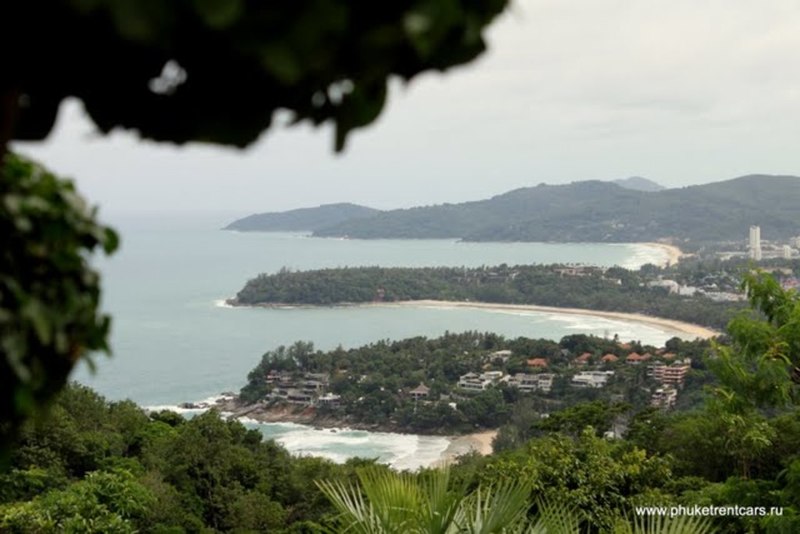
Karon Viewpoint
It offers an excellent view of Kata Noi, Kata and Karon beaches. There is a guy on the motorcycle just before the viewpoint that offers to get your picture taken with eagles. It costs 100 baht if using your camera or 200 baht using his Polaroid.
Directions: it is located between Kata and Naiharn beach.
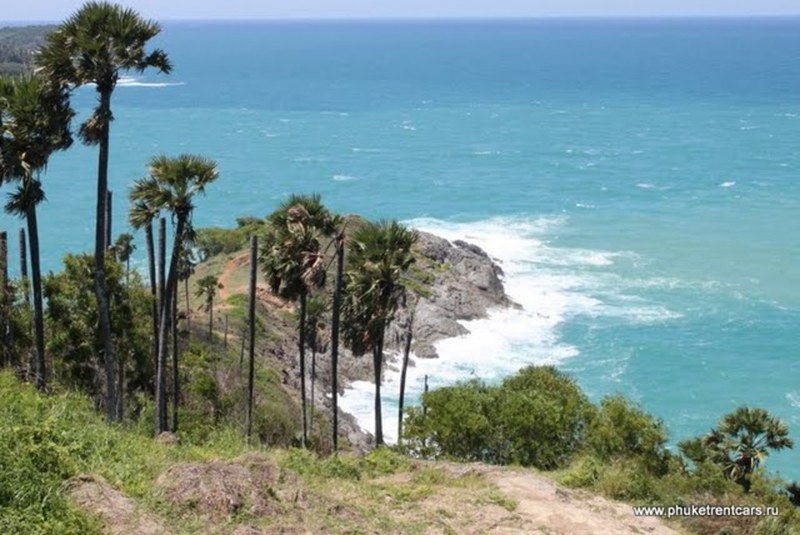
Cape Promthep
WORKING HOURS
Круглосуточно
COORDINATES
GPS
7°45'32.9"N 98°18'13.2"E
Decimal
7.759139, 98.303655
This place can be called the landmark of Phuket. Whether you come here to enjoy a sunset or to take a few pictures you won’t be disappointed.
There is a working lighthouse on the Cape with a small historical Museum inside. On the way to the lighthouse, you will find a shrine. Thai people believe that such a beautiful place is certainly inhabited by strong spirits. To gain spirits favor or pay respect Thais often bring offerings or gifts to the shrine. You can buy a gift for yourself or your loved ones at a souvenir market located in front of the parking lot.
Most people don’t go beyond the concrete barrier wall. But there is a dirt path leading down that will take you directly to flat stones, gently sloping into the sea.
Directions: from Chalong roundabout head to Rawai Beach then turn right and follow the signs.
The place gets crowded so in order to find parking it is best to come one hour before sunset. Sunrise and sunset times can be found here…