Travel guide Thailand
Phatthalung
A symbol of Phattalung province is the Mount Khao Ok Thalu that is 177 m high. If you climb the steps to the top you will see the whole city.
Phatthalung is often mentioned as a birthplace of Manora Dance (you can see it on YouTube), that is very popular in the South of Thailand. It is believed that this style of dance was influenced by South India.
Places of interest in Phatthalung
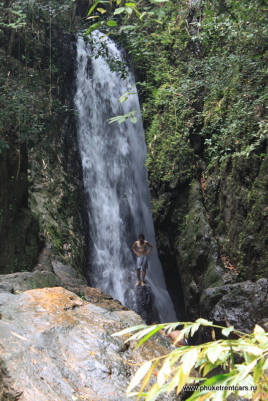
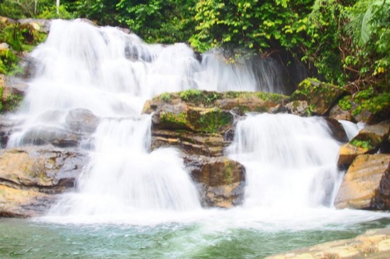
Phrai Wan Waterfall, น้ำตกไพรวัลย์
A waterfall in the tropics is a place where you can refresh yourself after a long road on a hot day. This one is no exception. Several quite comfortable natural stone tubs are ideal for a dip in the cool water.
Langkawi, Malaysia
We have included this island because it can be easily reached from Koh Lipe by a high-speed ferry. The ferry operates from Bundhaya Resort on Pattaya Beach twice a day from mid-October to the end of May. The trip takes one hour.
Boat schedule:
Lipe – Langkawi 10:30, 16:30*
Langkawi – Lipe 9:30, 14:30*
A one-way ticket cost 1200 baht for an
adult and 720 baht for a child
*Afternoon departures are only available from October to May.
!Please, make sure that you don’t require a visa to enter Malaysia before the trip. If you overstayed your Thai visa an overstay fine should be paid at an Immigration office in the city of Satun on the mainland prior to departure to Malaysia by ferry.
Once you reach Langkawi take a taxi to Pantai Cenang. That is where most of the hotels are located.
If you want to explore the Island rent a motorbike. It costs anywhere from 300 – 800 Malay Ringgit (approx. 300 – 800 baht) depending on season and size of the engine.
From Phuket South of Thailand
For many people, the word “South” evokes warm feelings and beautiful images. South of Thailand does not disappoint expectations. People living in the South of Thailand are open and easy going.
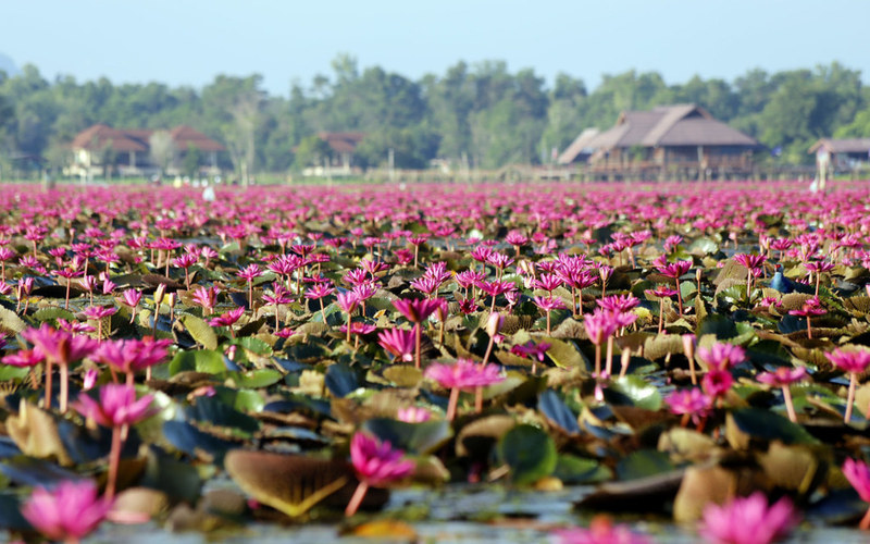
Everyone knows that migratory birds fly to the South, but not many know that they stop in Thailand. Follow the path of migratory birds, go to the South and you might get a chance to meet them at Thale Noi Waterbird Reserve, place unknown to most. But we will talk about this in due time…
Following provinces and places of interest should be included
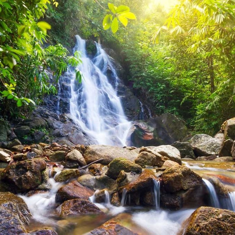
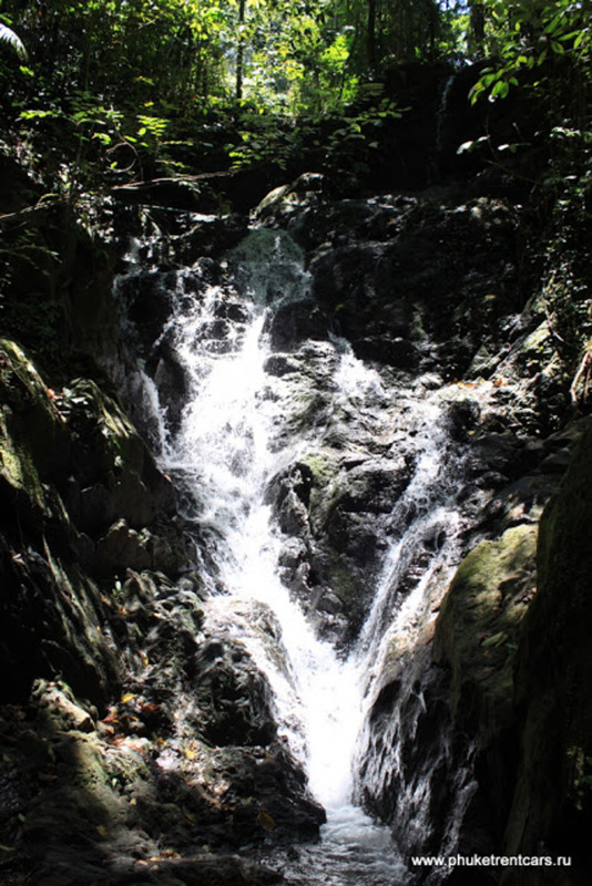
Namtok Sai Rung Waterfall, น้ำตกสายรุ้ง
A wonderful place if you want to feel at one with nature. Very few people come here. The clear water thunders over large boulders among tropical trees.
Some larger boulders along the river bank reach 10-15 meters in height. But even smaller ones are impossible for a person to lift. It feels great to get into the water for a refreshing dip on a hot day.
We felt awestruck the first time we saw the waterfall and the pool in front of it.
Waterfalls are especially beautiful in the rainy season from May to October.
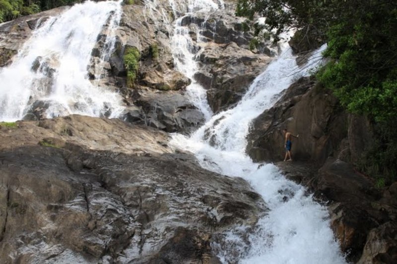
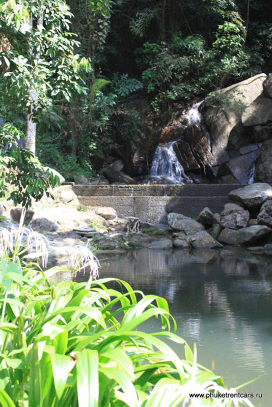
Namtok Ton Te Waterfall, น้ำตกโตนเต๊ะ
Take a nice stroll along a man-made well cared trail through a forest to see Namtok Ton Te cascading over slightly sloping rocks. It is higher than Sai Rung waterfall.
Waterfalls are especially beautiful in the rainy season from May to October.
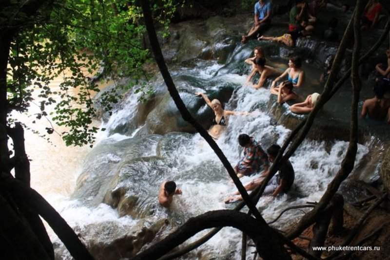
Ron Khlong Thom Waterfall
A 200-meter long path along the crystal clear stream leads to the stone bathtubs. However, it is better to go a little further, to the hot waterfall.
The waterfall consists of about 5 levels. Every level is like a small pool. There are signs that say: the water temperature is about 40 degrees C; mineral composition (mg/l) – lead is less than 0.0001, nitrogen 0.09, fluoride 1.09, copper is less than 0.0001. For health benefits, it is advised to spend 20 minutes in the water, but no longer than 20 min! What can be better for your tired feet and body after a climb than a hot bath? The water here is very clean; there are many natural ledges in the tubs, where you can get comfortable. The waterfall flows into the river where water is cool, perfect for contrast baths.
Go for a Thai massage by the river (50 m from the waterfall) and you will reach nirvana. Don’t forget to take some cash with you.
At the exit of the Park, near the Parking lot, you will find a few restaurants with delicious Thai food, the prices are low. I suggest you order a bowl of fried rice with chicken and egg (Kao pad Gai Kai Dao in Thai.)
! Directions: from the city of Krabi head South on highway 4 for 38 km to the village of Khlong Tom, continue on route 4038, 4021 and follow the signs.
Ticket: 90 bath
Parking: 20 bath
Ton Sai waterfall
WORKING HOURS
08:00 — 17:00
FEE
Adult
200 THB
Kid
100 THB
COORDINATES
GPS
8°01'42.8"N 98°21'47.0"E
Decimal
8.028545, 98.363060
Tong Sai waterfall is different from other waterfalls on Phuket. It is 2km long that make it the longest and the second highest on the island. It is not a waterfall where a high volume of water plunging down from a high cliff. It rather just flows over rock steps and a few small ledges where you can get under the stream for a natural massage.
If you decide to take a trek around the falls, wear comfortable shoes and be prepared that the trail might disappear under fallen trees, and you will need to find a detour.
Directions: from Heroines Monument head North, at the traffic light turn onto highway 3004( Namtok Ton Sai) and go straight.
Kathu waterfall
WORKING HOURS
08:00 — 18:00
FEE
Adult
0 THB
Kid
0 THB
COORDINATES
GPS
7°55'57.0"N 98°19'20.9"E
Decimal
7.932499, 98.322459
One of the smallest waterfalls in Phuket, both in height and in size of land it occupies. However, it has more natural pools than others that are located on 4 levels.
This is a place to visit if you don’t want to travel far and just want to freshen up in cool water.
The path to the top begins to the right of the waterfall and it takes you to the other three levels. It is quite picturesque.
Directions: from Central Festival shopping mall head to Patong. When you pass Caltex gas station you will be able to see a sign for Kathu Waterfall on your left.
Bang Pae waterfall
WORKING HOURS
08:00 — 18:00
FEE
Adult
200 THB
Kid
100 THB
COORDINATES
GPS
8°02'21.6"N 98°23'28.8"E
Decimal
8.039326, 98.391332
This is the biggest of the 3 best-known waterfalls on Phuket. At the base, there is one pool for swimming. The trail leading to the fall is picturesque and not overly taxing and long.
This place is also a home to the Gibbons Rehabilitation Center established in 1992. The center takes care and rehabilitates rescued, wounded and left without parents monkeys.
Volunteers working at the center deserve great respect. They are always happy to talk about the project and answer questions about gibbons.
You won’t be able to touch or even get close to the monkeys at the center but there is plenty of interesting information posted around. One of the center’s goals is to educate visitors. Next time you are offered to get your picture taken with a baby gibbon on the streets say NO. Most tourists don’t suspect that a gibbon mother is usually gets killed when poachers take a baby gibbon from her.
Directions: from Heroines Monument take highway 4027 and head East for 9 km till you see the sign “Bang Pae Waterfall”, keep driving from the sign for about 1 km.