Travel guide Thailand
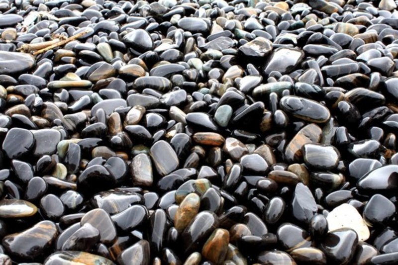
Hin Ngam Island, เกาะหินงาม
There are many small islands around Koh Lipe that you can explore by hiring a boat. You can stop at one of them to enjoy a deserted beach or go fishing and snorkeling.
The most impressive island of them all is Hin Ngam. What is unique about it is that it is covered with shiny black rocks. You can spend hours playing with them but stones are not to be removed from the island. It is believed that if you take even one small stone it will bring misfortune into your life until you return it back to the island.
The flat shape of stones is good for building towers or pyramids and many visitors do that. Lay down on your belly and look toward the horizon and you will see a mysterious city of stone towers.
!Bring your own snorkel and mask or rent them at the hotel before the trip.
How to get to Koh Lipe: speedboat from Pak Bara pier
In high season boats from Pak Bara Pier (ท่าเรือปากบารา) depart to Koh Lipe twice a day, in low season - once a day. It takes about 2 hours to reach the Island.
The schedule of speedboats and ferries can be found on www.kohlipethailand.com
A ticket to the island of Lipe is usually sold for a round trip with an open date for the return leg. The price depends on the operator and the season.
Where to leave the car — Parking
If you want to spend a few days on Lipe and the nearby islands, leave the vehicle in secure parking near the pier Pak Bara. Car Parking is on the left side, 50 m from the pier.
Accommodation in Satun
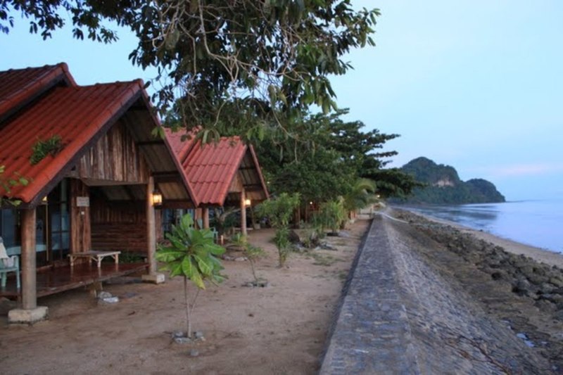
Satun province Langka hotel (ลังกา)
The unique feature of this hotel is that its bungalows are located right on the beach. While the beach is not good for swimming you can’t beat the view, especially at sunset and the atmosphere is nice. On the horizon, you can see the Islands of Langkawi and Tarutao.
The hotel is close to the pier where ferries and boats depart to the island of Lipe.
Accommodation in Satun
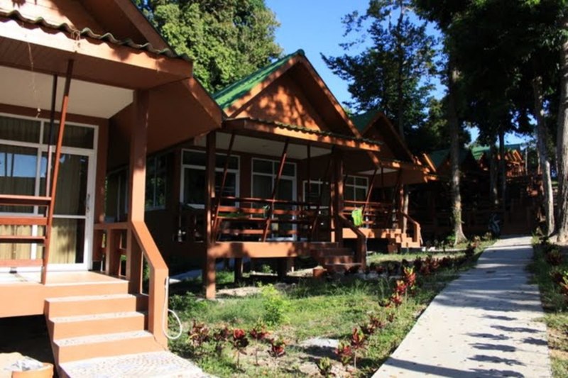
Lipe Island Mountain Resort
This hotel features bungalows located on the hill in the north part of Sunrise Beach. Many bungalows have sea view. They offer bungalows with a fan or AC. A staircase leads down to the beach with pure white sand and clear sea.
One of the advantages of this hotel is its proximity (10 min walk heading South) to the pier where you can hire a water taxi to explore nearby islands.
Restaurants in Satun
Satun. Muslim restaurant
There are many restaurants, mainly between Pak Bara Pier and hotel Langka. But to truly experience a local cuisine go to where locals eat. That means head to the town where all shops and eateries are located along the only street in town. You can hardly call it a town.
You should try Roti (flat bread) with curry sauce (โรตีน้ำแกง), hot tea with milk (ชาร้อน), sweet Roti (flat bread) (โรตีกรอบ).
From Phuket South of Thailand
For many people, the word “South” evokes warm feelings and beautiful images. South of Thailand does not disappoint expectations. People living in the South of Thailand are open and easy going.
Everyone knows that migratory birds fly to the South, but not many know that they stop in Thailand. Follow the path of migratory birds, go to the South and you might get a chance to meet them at Thale Noi Waterbird Reserve, place unknown to most. But we will talk about this in due time…
Following provinces and places of interest should be included
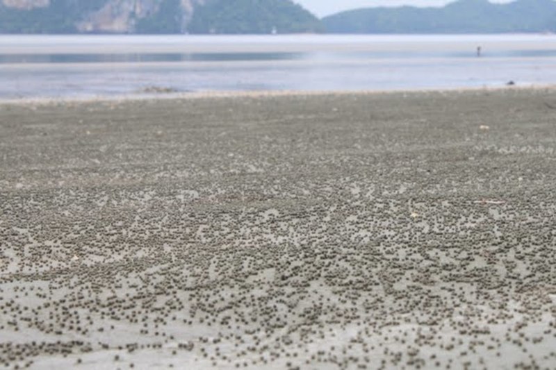
Hat Pak Meng beach, หาดปากเมง
The first thing that catches the eye is a wide strip of the beach and a lot of people collecting something in the shallow water. As it turned out the beach is scattered with cone-shaped shells and almost every shell has a hermit crab. It looks unordinary, many small cones "crawling" in the shallow water.
Following the example of locals we walk in the shallows along the coast. Here you can find unusual marine life, such as a starfish or fish that hides in the sand. Limestone mountains in the distance complement the picture perfectly, creating a nice background for photos.
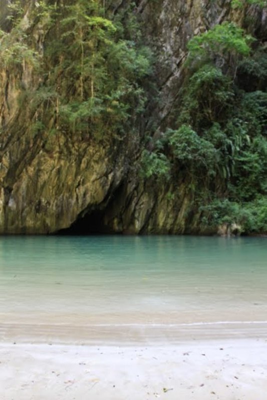
Ko Muk Island and Tham Morakot Cave, เกาะมุก-ถ้ำมรกต
In reality, the cave is a passage under the island of Muk, which leads to the inner lagoon. Many visitors tend to rush as they think they have already seen similar caves on the trip to James Bond Island.
Please, don’t, take your time. On this trip, the boatman will drop you into the water at the cave, and you will need to swim to the inner lagoon. You will need to swim for about 80 m. through the dark passage with a flashlight.
It is indeed an unforgettable experience! The sun shines through the opening and illuminates the first grotto. Its reflection is giving the water a gorgeous emerald color. But sunlight does not penetrate further than 10 m. Further into the tunnel, the only source of light you will have is your guide’s flashlight. The lagoon is untouched, sunny and clear. The whole experience makes you feel like a lucky discoverer.
The passage is not accessible at high tide. The water level should be no more than 2.5 m. We advise you to check the tide table in advance at the following sites: www.navy.mi.th or www.saltwater-dreaming.com, on the map choose Pak Nam Trang.
! Keep in mind that from May to October the wind blows from the sea and creates waves at the entrance to the cave. Please, be careful and do not risk it. A long-tail boat can be hired from the Pak Meng Pier ท่าเรือปากเมง, N07°30,444', E99°18,738'
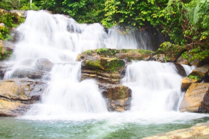
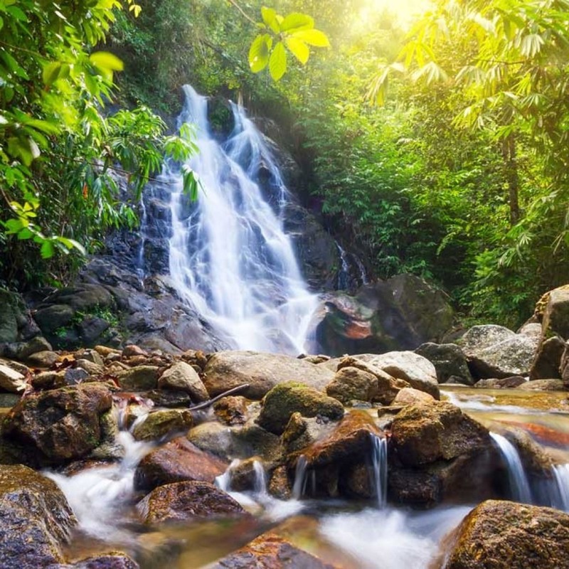
Namtok Sai Rung Waterfall, น้ำตกสายรุ้ง
A wonderful place if you want to feel at one with nature. Very few people come here. The clear water thunders over large boulders among tropical trees.
Some larger boulders along the river bank reach 10-15 meters in height. But even smaller ones are impossible for a person to lift. It feels great to get into the water for a refreshing dip on a hot day.
We felt awestruck the first time we saw the waterfall and the pool in front of it.
Waterfalls are especially beautiful in the rainy season from May to October.
Namtok Ton Te Waterfall, น้ำตกโตนเต๊ะ
Take a nice stroll along a man-made well cared trail through a forest to see Namtok Ton Te cascading over slightly sloping rocks. It is higher than Sai Rung waterfall.
Waterfalls are especially beautiful in the rainy season from May to October.