Travel guide Thailand
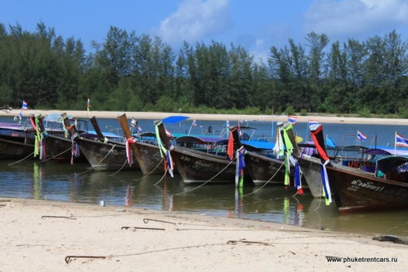
Here are rental rates for water taxis to nearby islands
WORKING HOURS
08:00 — 16:00
Islands: Poda + Tub
Max. occupancy: 4
Duration: half of the day
Price for boat in Thai baht: 1 700
Islands: Poda + Chicken
Max. occupancy: 4
Duration: half of the day
Price for boat in Thai baht: 1 700
Islands: Poda + Tub + Chicken + Phranang cave
Max. occupancy: 6
Duration: 8:00 - 16:00
Price for boat in Thai baht: 2 200
Island: Hong
Max. occupancy: 6
Duration: 8:00 - 16:00
Price for boat in Thai baht: 2 500
A one-way join-in water taxi ticket to the #Railay West beach and Phranang costs 100 baht per person. But you will need to wait until the boat has at least 8 passengers. A private transfer costs 800-1000 baht.
Have a great trip!
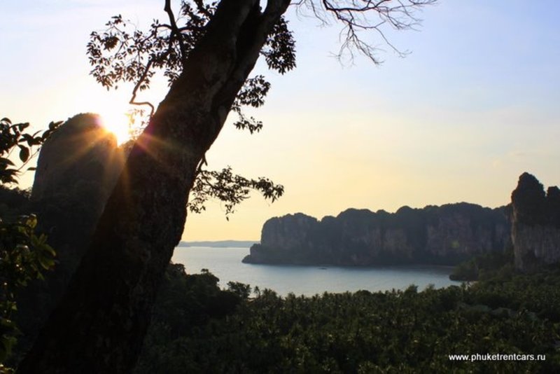
Ao Railay
Railay peninsula can only be reached by boat. On Railay West beach you can swim at high tide. There is a path that connects Railay West to Railay East. Railay East is not good for swimming, but it is a favorite spot for rock climbers. There are many climbing routes of different difficulty. You can rent equipment and hire an instructor.
Moving further along the coast to the South along the cliff you can walk to the southern part of the peninsula called Phranang, home to a cave that carries the same name. According to legend, the spirit of a woman called Phranang lives in the cave. One day her husband went fishing to sea, but a strong storm developed and he never returned. The woman remained faithful and waited for him all her life.
It is believed that if you want stability in family matters or if you want to have children or meet a man you need to make a special gift to the spirit of Pranang. This gift should be a phallus cut by you from a piece of wood. Locals also believe that even if you release such a gift into the sea anywhere in #Krabi, it will float toward the cave. Men also bring offerings in the form of flowers and food when they go fishing to ensure a safe return home and a good catch.
Walking on the path from East Railay to Phranang Beach you will see a trail to the viewpoint and to the inner lagoon. If you decide to go there please, note you will need to climb rocks, sometimes using a rope, therefore, wear appropriate shoes or go barefoot (the rocks are smooth).
! We do not recommend you to climb to the view point after the rain.
A one-way water taxi ride to the #AoRailay West beach and Phranang costs 100 baht per person. But you will need to wait until the boat has at least 8 passengers. A private transfer costs 800-1000 baht.
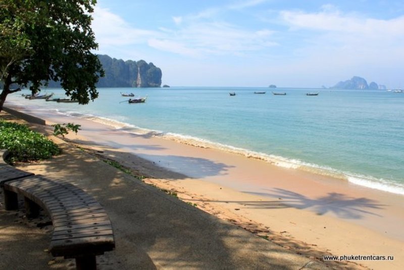
Ao Nang beach
#AoNang is the center of #Krabi ’s nightlife. You can have a nice walk along the main road, there are many restaurants, bars, shops and stalls, however, the atmosphere is very relaxed. Many places are only opened till midnight.
The beach offers a beautiful view of the sea and many small unusually shaped islands. Large trees grow along the beach. If you are planning to explore the area further you will find an office where you can buy tickets for a water taxi or book a private trip at the Eastern end of the beach.
Moving West along the coast, you get to the Nopparat Thara beach. The West part of this beach is a National park. Another pier for water taxis is located here. Even in a windy weather there are no waves this makes it easier to board a boat.
Tup Kaek Beach
This is a very romantic place with gorgeous sunsets. Once it gets dark you will see hardly any lights or people outside hotels, but there are plenty of crabs roaming the beach. You can dine on this beach at one the hotels’ restaurants and they offer more than just crabs.
Kao Hang Nug
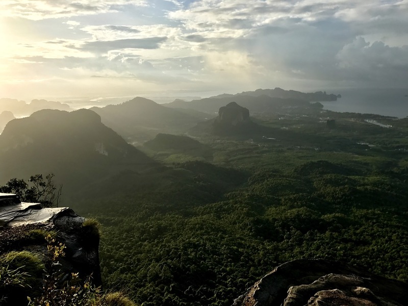
Krabi province is famous for its cliffs. The #NagaTail ridge is one of the best places where you can enjoy its beauty at the fullest.
You will meet 3 different names for this place:
#KaoHangNug (เขาหางนาค) - the Tail of Naga;
#KaoNgonNug (เขาหงอนนาค) – the Ridge of Naga;
#TubKaek (ทับแขก) - it is also the name of the neighboring beach.
Mount Kao Hang Nug (Naga Tail) is a ridge that starts from the Tub Kaek beach on the West coast of #Krabi and stretches to the East. You can climb up and down the mountain in one day, but if you want to really enjoy the beauty of this place, you need to camp there for the night. In contrast to the temple Wat Tham Suea, road to the top runs through the jungle. The length of the hike to the top is 3.7 km, with a visit to a waterfall along the way is 4.7 km.
! Directions: to get to the starting point of the hike head to the Tub Kaek beach (ทับแขก), then follow the signs to the Hat Noppharat Thara - Mu Kho Phi Phi National Park.
Sa Morakot – Crystal Pond
WORKING HOURS
until 17:00
FEE
Adult
200 THB
Kid
100 THB
There are 2 routes leading to the Emerald Pool, one is wide gravel path 800 m long and another is a nature trail 1400 m long.
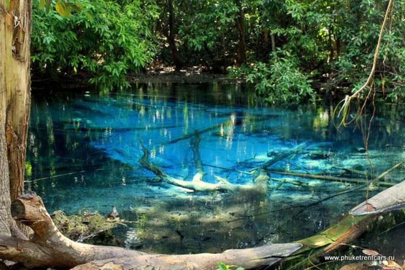
A sign says: Sa Marakot or emerald lake is a pool fed by hot springs, 25 m in diameter, 1-2 m deep and the water temperature is 30-50 degrees C. It is likely that this is the water temperature before it reaches the surface because the water in the lake is slightly cool. The water flows into the lake from porous rocky layers and through cracks in the stone at the bottom. Bacteria and algae living in the pool, along with high temperature tint it with different hues. Water is greenish-blue in the places where the temperature is higher and pale green where the temperature is lower.
The lake is indeed very beautiful, One shore is sloping and rocky and another is overgrown with trees. The yellowish color of the stones at the edges is caused by deposits of calcium carbonate on its surface which makes them very slippery. Please, be careful while getting in or out.
500 meters upstream there is another lake with blue water. The path to it passes through a mystical landscape, over wooden bridges, and through the jungle.
Directions: 2 km from the hot springs described above.
Parking: 20 THB
Ron Khlong Thom Waterfall
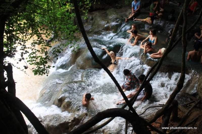
A 200-meter long path along the crystal clear stream leads to the stone bathtubs. However, it is better to go a little further, to the hot waterfall.
The waterfall consists of about 5 levels. Every level is like a small pool. There are signs that say: the water temperature is about 40 degrees C; mineral composition (mg/l) – lead is less than 0.0001, nitrogen 0.09, fluoride 1.09, copper is less than 0.0001. For health benefits, it is advised to spend 20 minutes in the water, but no longer than 20 min! What can be better for your tired feet and body after a climb than a hot bath? The water here is very clean; there are many natural ledges in the tubs, where you can get comfortable. The waterfall flows into the river where water is cool, perfect for contrast baths.
Go for a Thai massage by the river (50 m from the waterfall) and you will reach nirvana. Don’t forget to take some cash with you.
At the exit of the Park, near the Parking lot, you will find a few restaurants with delicious Thai food, the prices are low. I suggest you order a bowl of fried rice with chicken and egg (Kao pad Gai Kai Dao in Thai.)
! Directions: from the city of Krabi head South on highway 4 for 38 km to the village of Khlong Tom, continue on route 4038, 4021 and follow the signs.
Ticket: 90 bath
Parking: 20 bath
Wat Tham Suea or Tiger Cave
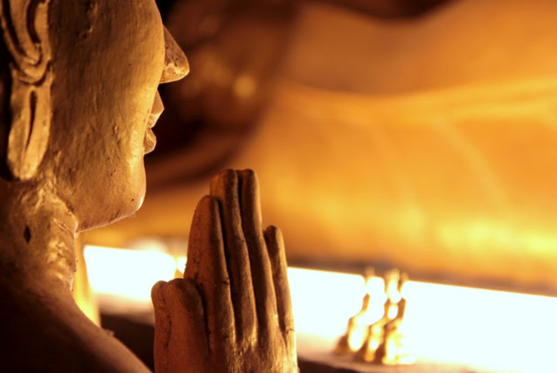
The sign at the entrance says this is a place for meditation. Founded in 1975 by a monk Chamnian Silsetso, known for his knowledge in teachings of Vipassana in 1975 (Note: Vipassana — means to see things as they really are. www.dhamma.org). It is believed that in one of the caves used to live a leopard (not a tiger as the name suggests).
This is a large complex. At the entrance, you will find a small shop. It is better to buy food on the way out otherwise furry tailed inhabitants won’t leave you alone.
The entrance to the Tiger cave is immediate to the left along the cliff. There is a structure built in front of the rock for meditation and meetings with the monks. To enter the cave you need to walk through this structure. Inside you will find a footprint of the Buddha, where you can leave a coin and make a wish.
Going further along the road deep into the complex, on the left side, you will see two paths to the mountains. The first leads to the top of the mountain (1237 steps), the second to the "old" forest.
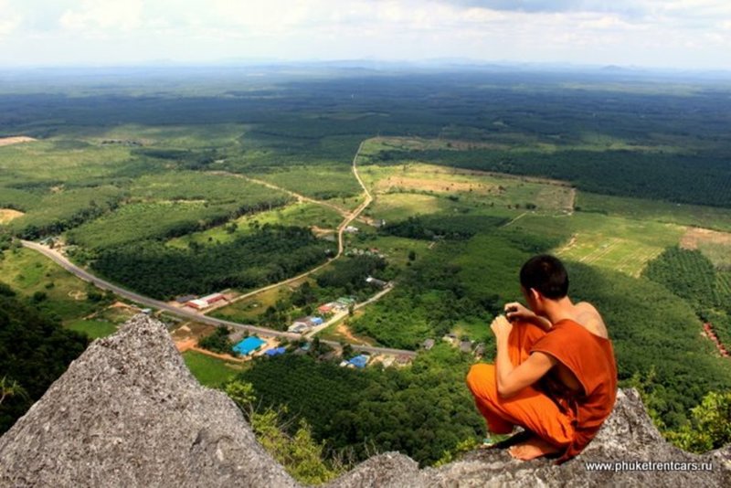
There are 1237 steps leading to the top of this 600 feet high mountain. It's not an easy walk. The steps are narrow and steep. In some places stair risers are up to 40 cm high, you have to use your hands to help yourself. To keep you occupied this 25-30 min, this is how long it takes to get to the summit, columns are installed along the staircase at the edge that show you how many steps you have ascended. Once you get to the top you will be rewarded with a panoramic view of the surrounding area. Also, cold drinking water is available there.
One day on the way up I passed an old Thai man. He got to the top only 10 minutes behind me. He was 72 years old! This is for those of you who after reading this decided not to climb to the top.
Old forest: once you get over a small hill you get to the forest, it is truly a forest, not a jungle. The walk is easy here, there are many different paths. If you take the far left footpath it will lead you back in a circle to the starting point. On the way, there are a few caves with rock paintings. People come here to enjoy the silence. The trees are tropical with large and wide buttress roots. The largest tree I found was about 9 meters wide at its foundation! Standing next to that tree it was hard to believe that it was a living thing. It felt like I was leaning against a rock. The temperature in the forest is cool so that 20-minute walk around the circle is not tiring.
In the middle of the complex, before the staircase to the summit or in front of the Tiger cave, you will find monks and nuns. If you approach with a smile and ask they will tie a braided bracelet to your wrist, blessed for good luck. Make a wish or they themselves often wish for foreigners a lot of money, do not say “No”.
! Directions: from Krabi head East on highway 4, before you reach Big C supermarket turn left onto highway 6017, follow the road for 2 km.
Phi Hua To Cave or Big-headed Ghost Cave
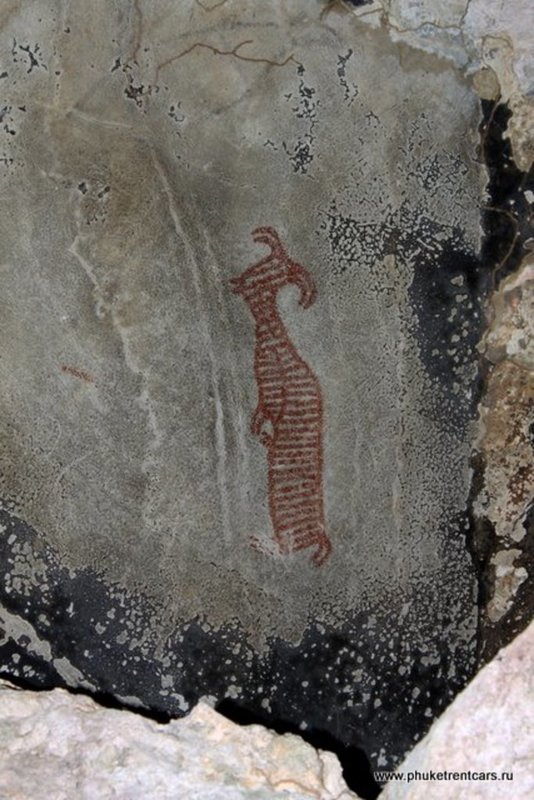
Formation of the cave dates to the Carboniferous and Permian period of the Paleozoic era, about 230-340 million years ago. The floor of the cave is made from numerous shells pressed together. According to legend, a huge human skull was found here. This fact, as well as related prehistoric drawings, gave the cave its name Big-headed Ghost Cave.
70 rock paintings depict people, animals, and other strange creatures. The drawings are about 3000 years old. The authorship is attributed to a prehistoric tribe of sea Gypsies called Chan Chao Nam. Natural ingredients were used to make the paint, for example, rubber and animal blood were mixed to produce a red color.
! Directions: from the Thasai restaurant head East on highway 4, 415, 4, 4039, continue straight at the traffic light until highway 4012, then follow signs.
Canoe 2 pax: 300 thb/hour
Boat 8 pax: 400 thb/hour
Thasai seafood
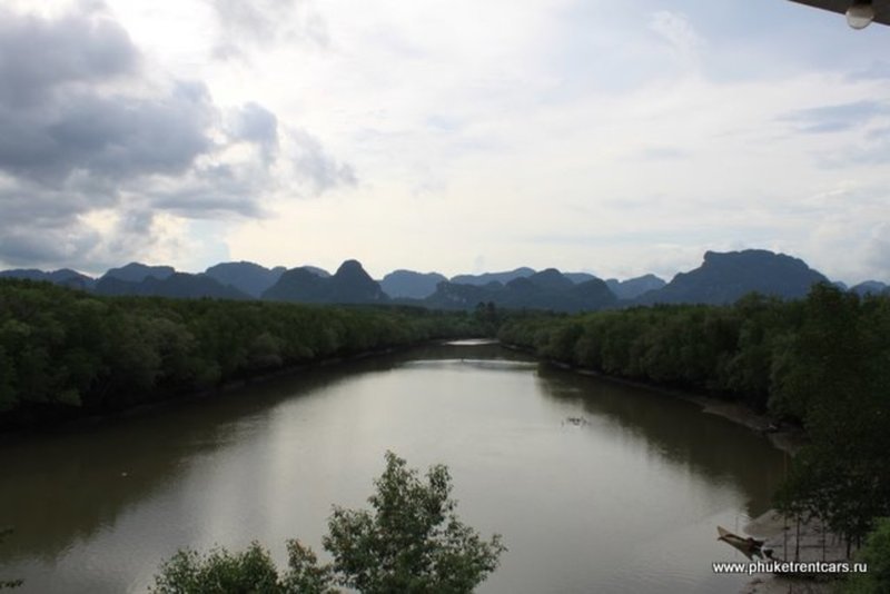
The restaurant is located on high river bank and has great views.
! Directions: from the Monkey Temple head North on highway 4, 415 and 4044 for 2 km.